

Where is Bay Park? Waldo won’t be much help for you on this one.
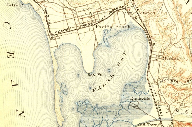
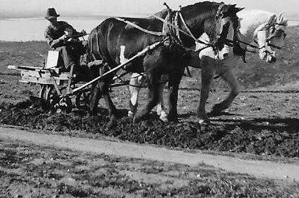
An 1887 map filed with the San Diego County Recorder by the Morena Company shows numerous blocks, lots and streets east of False Bay (Mission Bay) and the parallel Southern California and Pacific Beach railroad tracks. There is also a wharf on a pier with adjoining bath house and boat house that extended into the bay.
Who knew Bay Park was “there” over 130 years ago? The map proved to be wishful thinking and the Morena district would not become developed until almost a half-century later.
A 1903 U.S. Geological Survey map titled La Jolla Quadrangle has what appear to be four streets in Morena on the east edge of False Bay, north of Duckville and Old Town. It is important to note that the highlighted route of the Pacific Beach and La Jolla Rail Road connects with the Southern California Rail Road (“Surf Line”) at Morena. A depot was erected near what is modern day Morena Boulevard and Kane Street. In that era, a depot junction was the harbinger of business and residential development.
In 1905, Mr. Josephus M. Asher, Jr. married Miss Mabel Olive Littlefield in Pacific Beach. Josephus and his brother-in-law, Warren Littlefield, became involved in beach area real estate. The company also subdivided property south of Morena as Clover Leaf Terrace.
An Asher-Littlefield advertisement in the December 1909 issue of Santa Fe Employe’s (sic) Magazine touts the potential of investment in Pacific Beach and Clover Leaf Terrace real estate.
The P.B. and San Diego Rail Road stopped running in 1919 and the Morena depot was razed in the early 1920s. America’s love affair with the automobile had begun.
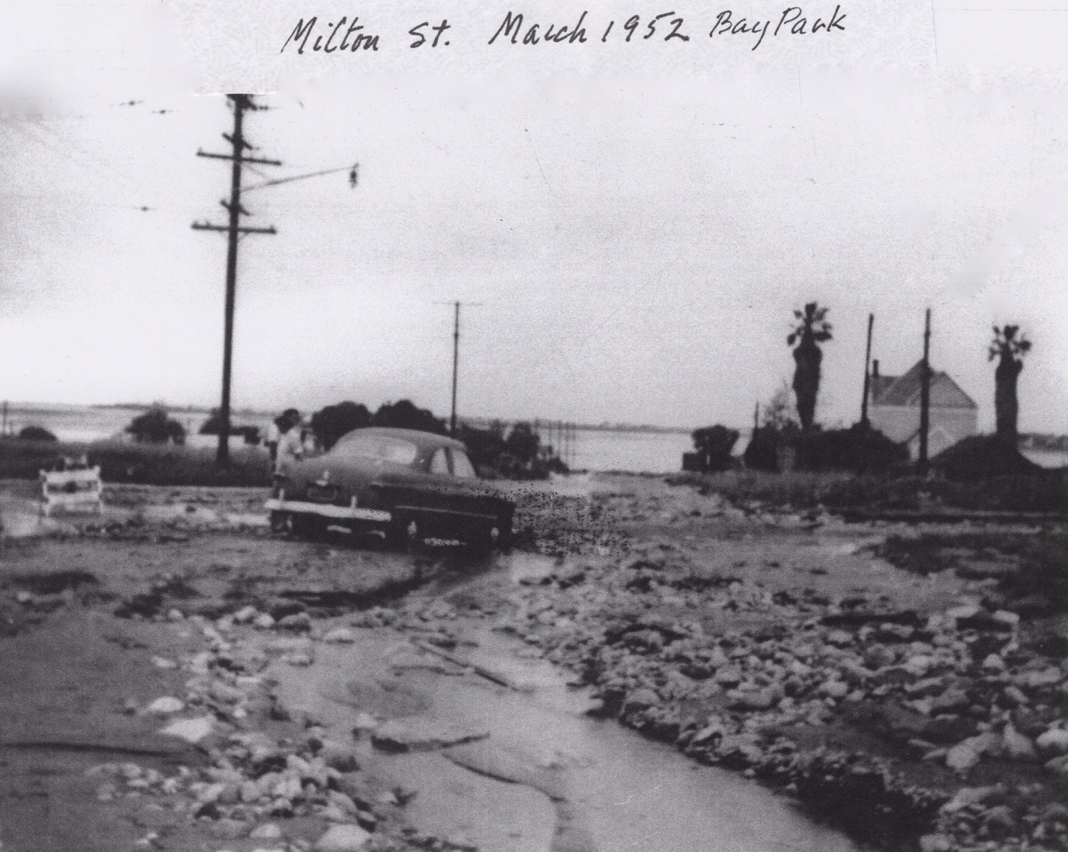
The Bay Park Village subdivision, south of Milton Street, was approved by the San Diego City Council in 1936. Ten intensely boring, single-spaced legal pages from the minutes of the September 6, 1938 city council meeting deal with elevations for the following Bay Park Village streets: Frankfort, Erie, Denver, Goldfield, Chicago, Mayo, Napier, Ashton and Littlefield.
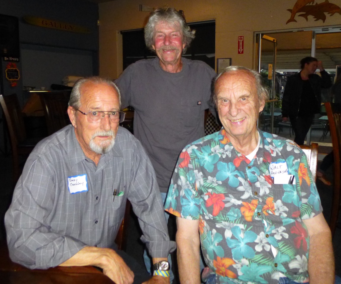
Karl Croft grew up in Bay Park Village. Danny Cline’s family operated Ambort Dairy in the Morena subdivision north of Milton Street. Both are in their late seventies and remember when people would say they were going “to the village.”
Bay Park Elementary School, built in 1939, was actually located in the middle of the Morena neighborhood.
Walter Andersen’s family moved to Denver Street in 1942. Walt laughs, “People think I’m nuts when I tell them Bay Park Elementary School isn’t even in Bay Park. Almost all have no clue what Morena is, other than Morena Boulevard.”

Who knew that Raquel Tejada Welch went to Bay Park Elementary School?
Linda Langdon moved to Bay Park as a young girl and lived in a Mayo Street home built in 1937. Every day as a teenager, she walked the roundtrip from “the village” to Clairemont High School. Linda also remembers riding horses on the Ambort property and recalled a pleasant, old African-American man who lived on the premises.
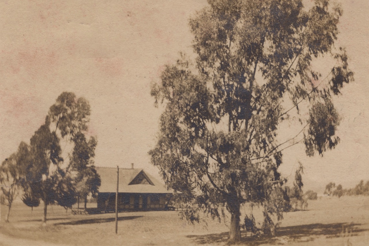
Danny Cline quickly identified the man (phonetically) as Dah-ming. He and Andy Mosberg worked at the Ambort Dairy. “Andy was a red-faced, alcoholic old Swede. My grandfather used to make wine and Andy was always drunk. The dairy closed in 1949 when the city condemned the property and put Clairemont Drive going up the hill through the middle of it.”
Croft remembers a shack near Napier Street by the railroad tracks that was moved to the corner of Orten and Frankfort. As a kid, he was fascinated that the dirt floor was covered with old rugs.
Gary Crowley’s family settled in 1952 and his father manufactured Crowley’s Caskets on Morena Boulevard. Mike Frye’s father was in the Navy and bought on Orten Street in 1941 before the war. A family legend involves his adventurous older brother, “Skip,” who strayed from home at a very young age and was found wandering around on the mesa top looking for a shortcut to the waves.
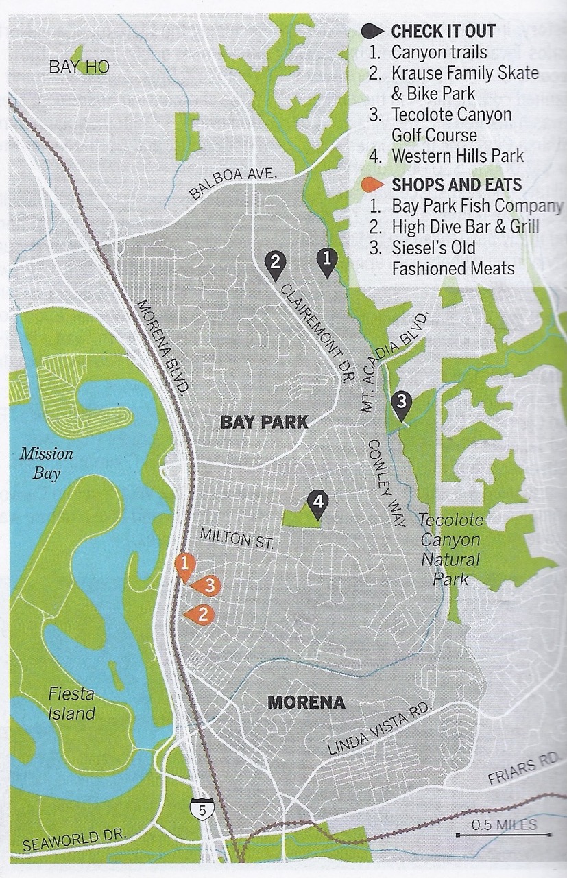
According to the 2013 SANDAG report on the Mid-Coast Corridor Transit Project, the completion of Interstate 5 in the late 1950s caused Bay Park Village to become isolated and go into “decline.” It was further noted that, .”By the 1950s and 1960s, Bay Park Village’s boundaries had expanded to Clairemont Drive to the north, Illion Street to the east, Tecolote Road to the south, and W. Morena Boulevard to the west.”
San Diego Community Almanac published by the San Diego Union-Tribune in 2018, describes “Bay Park & Morena” as “Mid-city oasis is close to Mission Bay and Tecolote Canyon Park.” The neighborhood’s name was shortened to Bay Park during the post-war mid-century housing boom. The boundaries have been magically extended north to Balboa, east and south to Tecolote Canyon into geography previously known as Clairemont.
The Community Almanac expounds, “Neighborhood boundaries are not set in stone, like a county or state boundary. For map boundaries and data, this almanac relied on the U.S Census Bureau, San Diego Association of Governments, police maps, community planning districts and input from local residents and public officials.”
From the beginning, real estate agents have played a seminal role in the expansion of Bay Park’s limitless boundaries… and increased property values.
Local Century 21 real estate broker Richie Morris explains, “Bay Park is the true sweet spot for bragging rights. 92110 is the coveted zip code… at a cocktail party, you can’t say I live in Bay Park with a 92117 zip code. That’s like saying I live in La Jolla (92037) when your zip code is 92122 (University City). Dr. Seuss would turn over in his grave.”
Morris recalls the topic being discussed during a meeting of the Bay Mesa Real Estate Association. When the question, “Where is Bay Park?” was put to the group, one of the members quipped, “That depends if you’re buying or selling.”
Looking into the future with Squaremont’s uncanny 20/20 foresight, housing will continue to be developed along the new trolley line just as Asher-Littlefield envisioned one hundred years ago.
Further, a hundred years from now, the Morena Boulevard corridor will be a valley of highly coveted 30 story apartment buildings on the banks of the Amtrak and Mid-City coaster tracks.
Because the trolley is not easily accessible from Clairemont, the mesa will become a ghost town inhabited by jackrabbits, rattlesnakes, the homeless and a single real estate office at the top of Clairemont Drive that will speculate in waterfront property with beach access as a result of global warming projections.
Before then, it is incumbent Clairemont High School change its name to Bay Park High School, so Madison can become the true Clairemont High.
Email: Bill@ClairemontTimes.com
To read all the Squaremont columns, visit:
")

